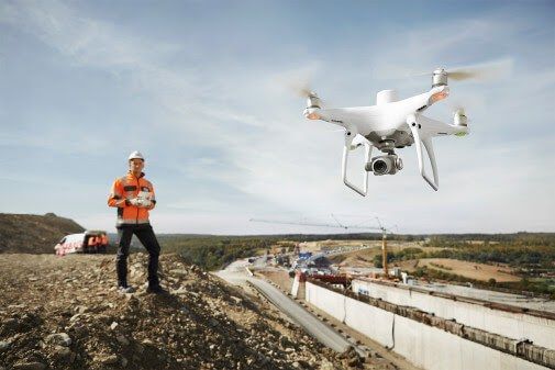
ICON has been an early adopter of Drone Survey Technology and has been providing effective aerial-land surveys and post survey analysis. Surveyors hold Drone Certifications and undergo training in Best-in-Class Drone Flying practices. A Detailed analysis and tracking is done, aided by software solutions for a comprehensive 3D mapping.
Purpose: The main purpose of this Drone Survey is to Survey and mapping services including of areas that face accessibility challenges. These Services result in manifold savings in time, cost and effort compared to traditional methods.
UAV / Drone Operation Features
- Clear boundary demarcation
- Clarity of image and boundary from 2 – 0.4 in/pixel
- Measurement accuracy 95 – 99%
- Very high grade image resolution
- Easily accessible data in computer and in printouts
- Post Processed data will be provided at intervals during the project or can be provided at end of project
- Captured data will be stored up to 1 year from project completion date and will be provided in case of data loss from customer
- Security of data captured
- Cloud access of digital data (online access)
- Third Party damage cover during drone operation will covered
- Highest health and safety precautions will be taken based on US/UK drone operations rules

Deliverable for Mapping
-
- A Digital Surface Model, defining the elevation model of the terrain/site
- A 3D model for visualization of land topology (.obj file, Clarity up to 60-98%)
- These can be imported in AutoCAD for further engineering development.
- Defining perimeter, area and distance measurement on the Orthomosaic data
- Accuracy of measurement on Geo referenced data up to 99.99%
Quotation for providing aerial land mapping using UAV systems and post processing the captured data to create a orthomosaic land map. With regards to the above subject, ICON will be mapping around 18 acres land near gonikoppa, coorg, and will be providing all the data in soft copy, among which the land survey map and other aerial view photos will be in image format (jpeg, tif) of the field. The technical details of the map provided is as follows
-
-
- A geo referenced orthomosaic map with GSD (Ground Sample Distance) 〜4 in/pixel.(image in geotiff format)
- A Digital Surface Model, defining the elevation model of the terrain/site
- A 3D model for visualization of land topology (.obj file, Clarity upto 50-70%)
- These can be imported in AutoCAD for further development.
-
As this is a preliminary survey, we have worked out the best possible price considering bare minimal cost for operation and post processing and giving you the fare resolution to view the map(〜4 in/pixel).
We can achieve higher resolution of upto 0.8 in/pixel based on your budget to explore more detail of your map to achieve clear boundary demarcation, overlapping the shape file and additional advantages. Also achieve greater clarity in 3D models.
The pricing will be higher due to increase in data capture(field operations) and post processing time Considering the above points please find the best quotation for your current requirement.
Advantages of drone based mapping
Firstly, using a drone can vastly reduce the time spent collecting accurate data. By acquiring raster data from the sky – in the form of geo-referenced digital aerial images, with resolutions as sharp as 1.5 cm (0.6 in) per pixel – you can gather millions of data points in one short flight.
More time still can be saved by using a survey-grade drone with RTK devices. Such GNSS/RTK receiver systems are effectively flying rovers, capable of receiving data corrections streamed from a base station or via VRS to achieve absolute X, Y, Z accuracy of down to 3 cm (1.2 in) – without needing Ground Control Points.
With collection made so simple, you can focus your energy on using and analyzing data, rather than working out how to gather it.
With such a large increase in the amount of physical data being collected, this does mean an increase in office time spent processing and utilising this data. However this expansion is cancelled out many times over by the huge time savings a drone produces out in the field. Many customers say, for example, that large jobs that once took weeks can now be completed in just a few days, and that a week’s worth of traditional data collection is now achieved in just one day.
Last but not least, less time spent on the ground means staff safety is improved by minimizing risk to surveying teams when measuring sites such as mines, unstable slopes and transport routes.
Please feel free to contact us for any query or clarification.
Drone Services Available in ICON
- Drone Survey / Mapping
- Digital terrain / Surface Modeling
- 360 Degree Views & Virtual Realty presentations
- Project Progress Monitoring
- Asset Inspection / Facade Inspection